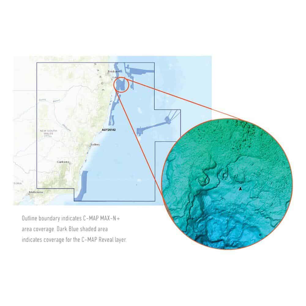
C-MAP® Reveal charts save time and help you find your key fishing spot faster. They give you a high-def look at the structures and contour changes on the seafloor. Just turn on the Shaded Relief setting in your chartplotter, and you’ll see the best fishing or diving spots with ease.
Features:
- High-definition C-MAP Reveal layer of the sea bottom on selected areas
- Reduces search time with immediate display of bottom structure, wrecks, isolated reefs and ledges
- Easy to use – just turn on Shaded Relief setting in chartplotter
- C-MAP Reveal charts contain full C-MAP MAX-N+ vector navigation data, including new features like High Resolution Bathy, Custom Depth Shading, Genesis layer and satellite imagery
- Includes detailed marina and port plans
- Most affordable sea bottom charts available


Reviews
There are no reviews yet.